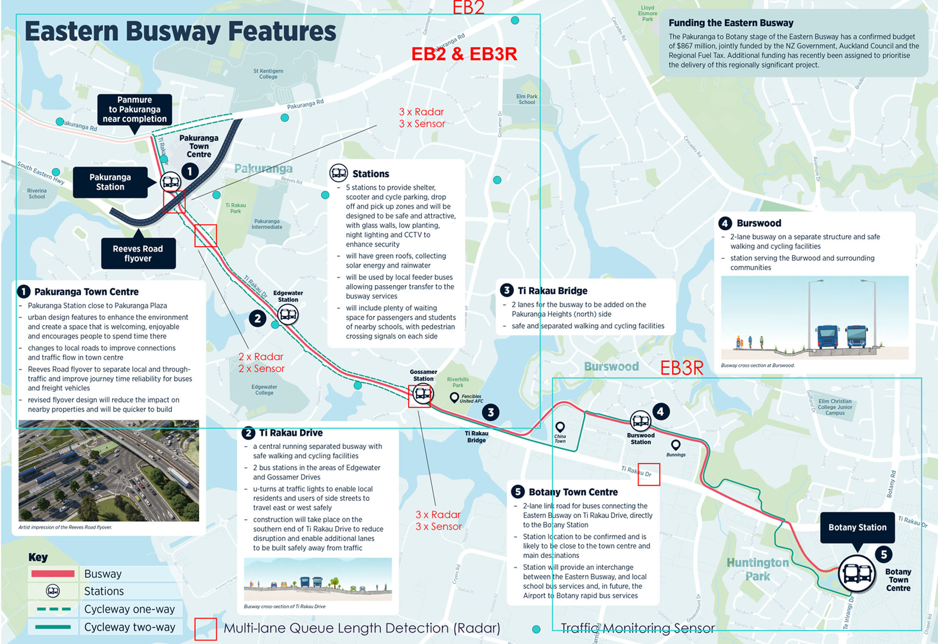
Reducing Workzone Congestion for Auckland's Eastern Busway Project
End-to-end solution integrates roadside sensors with edge computing power and cloud -based software
Overview
The Auckland Manukau Eastern Transport Initiative (AMETI) Eastern Busway is a group of projects in south -east Auckland which will improve transport choices and connections in the area – valued at $1.6b New Zealand Dollars. The Eastern Busway Alliance (EBA) was contracted to construct a new busway between two major suburbs that see high volumes of traffic congestion in Eastern Auckland. The project will grow the region's rapid transit network and will provide more reliable bus and train travel, including 5km of busway and 5 new bus stations, as well as 12km of separated walking and cycling routes. By 2028, it is estimated the busway will carry 30,000 passengers a day and will significantly improve bus and train services for East Auckland.
The Eastern Busway Alliance (EBA) is comprised of Fletcher Construction, ACCIONA, AECOM and Jacobs, they are tasked to design, consent and build the Pakuranga to Botany section of the busway. Their mana whenua partners and specialists in safety, community engagement, design and construction are working together, sharing their skills and knowledge to deliver this large and complex infrastructure project. They are responsible for ensuring a smooth construction process, minimising environmental and community disruptions and impacts.